23 ARTHUR MATTHEW DRIVE
Owner Information
KING MATHEW T & STACY L
23 ARTHUR MATTHEW DRIVE
HANOVER, MA 02339


Property Details
23 ARTHUR MATTHEW DRIVE is classified as a Single Family Residential (Colonial).
The primary structure on this property was built in 1976. There are 4,378ft2 of built area within this property. There is 2,424ft2 of residential/living space within this property. This property is listed as having 8 rooms.
23 ARTHUR MATTHEW DRIVE is valued at $638,700. The land is valued at $254,900 and the structures are valued at $359,000. There is an additional valuation of $24,800 on this property.
The most recent deed for 23 ARTHUR MATTHEW DRIVE is recorded at the local registrar in Book 33998, Page 41. 23 ARTHUR MATTHEW DRIVE was last sold on Friday, January 19, 2007 for $515,000.
Assessment data from fiscal year 2022.
Flood Data
According to the FEMA National Flood Hazard Layer, this property does not appear to be in a flood zone. It may also be in an area not yet reviewed. Nonetheless, confirm this information prior to taking any action.
To view the flood hazards around this property, create a FEMA "Firmette" Map of the area around 23 ARTHUR MATTHEW DRIVE.
Broadband Internet Providers
| Provider | Type | Bandwidth (mbps) | |
|---|---|---|---|
| VSAT Systems, LLC. | Satellite | 2 | 1 |
| HughesNet | Satellite | 25 | 3 |
| GCI Communication Corp. | Satellite | 0 | 0 |
| Comcast | Cable | 1000 | 35 |
| Verizon New England Inc. | Fiber | 940 | 880 |
| Verizon New England Inc. | DSL | 7 | 0 |
| Viasat Inc | Satellite | 100 | 3 |
Broadband service provider data from December 2020.
Adjacent Properties
- 371 WATER ST
Single Family Residential owned by HERNANDEZ JOSE LOUISE & LISA SUZANNE - 49 ARTHUR MATTHEW DRIVE
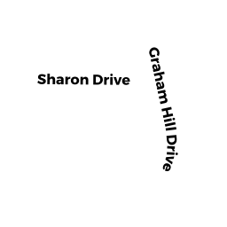
Single Family Residential owned by BROWN ROBERT C & BARBARA A - 99 GRAHAM HILL DRIVE
Single Family Residential owned by GRIFFIN ELLEN L - 111 GRAHAM HILL DRIVE
Single Family Residential owned by KING MARK V & BRENDA A (TE)